Before making landfall in South Carolina, Tropical Storm Chantal gets a little stronger; flooding and a lot of rain are predicted?
Before making landfall in South Carolina:
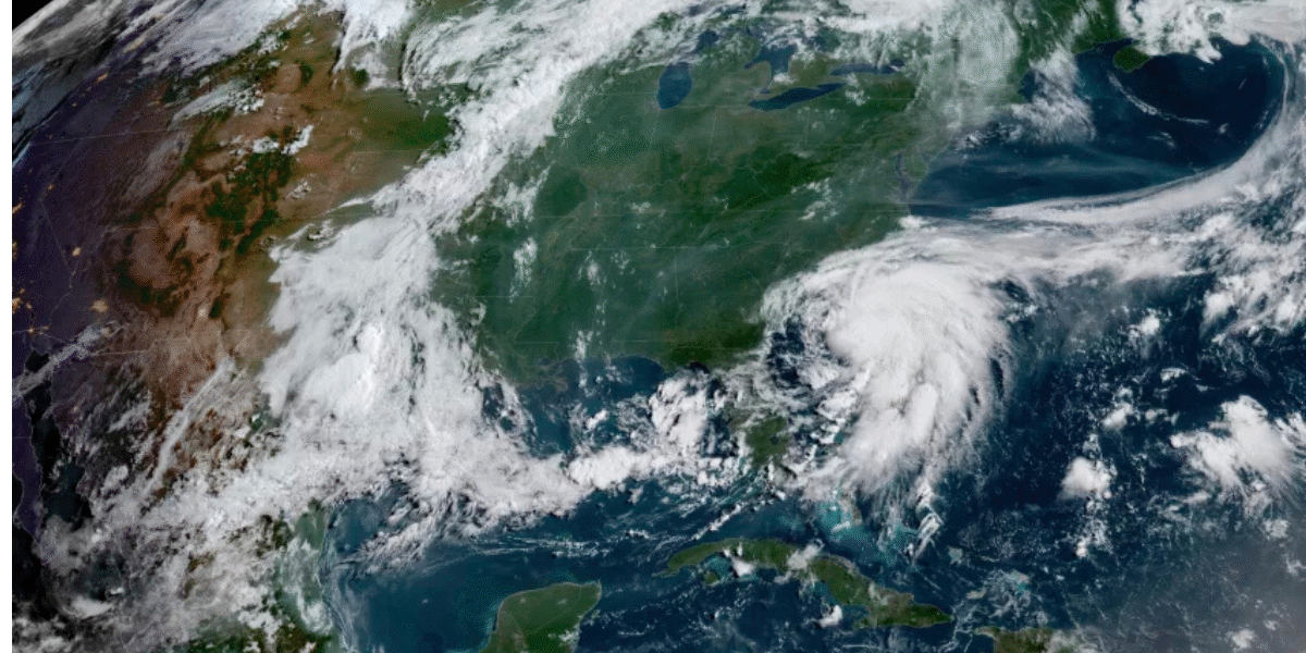
Miami, July 6, 2025 — As Tropical Storm Chantal approaches the U.S. As it nears the southeastern shoreline, signs of intensification are starting to emerge. The storm is expected to arrive in South Carolina in just a few hours, bringing threats of intense rain, localized flooding, and dangerous coastal conditions.
As Chantal moves closer to the coast, the National Hurricane Center (NHC) has issued tropical storm advisories for portions of North Carolina and South Carolina. Early Sunday, Chantal was located approximately 85 miles to the southwest of Wilmington, North Carolina, and around 75 miles to the east of Charleston, South Carolina, as it moved northward at a speed of 8 miles per hour.
Already, rain bands Arriving to the Seashore
Tropical Storm Chantal’s outer rain bands have already begun moving across the beaches of North Carolina, bringing with them spells of heavy rain and strong gusts. Flash flooding could quickly become a major problem, according to meteorologists, particularly in places with inadequate drainage or already saturated land.
In a public alert, the NHC stated that “localized flooding and heavy rain are likely across parts of the Carolinas.” “Residents should avoid driving on flooded roads and be ready for quickly changing weather conditions.”
Rainfall Totals and Flood Threat Through Monday, forecasters anticipate 2 to 4 inches of rain in eastern North Carolina, with some regions possibly receiving up to 6 inches. Bands that stall over one place for extended periods of time or areas close to the storm’s center are predicted to see the most rainfall.
Despite being moderate by tropical storm standards, these levels of rainfall may be sufficient to cause flash floods along creeks, streams, and rivers as well as in low-lying areas. Several counties in both states are currently under flood watches.
Risks of coastal flooding and tornadoes
The South Carolina Emergency Management Division (SCEMD) has issued a warning about the possibility of isolated tornadoes, particularly in the vicinity of the coast, in addition to flooding issues. These fast-forming tornadoes are unpredictable because they can happen in thunderstorms that are entrenched in Chantal’s outer bands.
The storm’s onshore winds and high waves may also cause minor flooding in coastal regions during high tide. Conditions for swimmers and boaters will be hazardous due to beach erosion, water on roads, and choppy waves. Both locals and visitors are asked to stay away from the beaches and pay strict attention to any emergency directives.
Road Safety Is Encouraged by Emergency Officials
Driving on flooded roadways is one of the biggest safety risks during tropical systems like Chantal. Officials at SCEMD highly advise against doing so. Local emergency services continue to emphasize the importance of turning around and avoiding drowning.
Even shallow water has the potential to conceal dangers or be powerful enough to carry a car away. Downed electrical wires, compromised roadways, and hidden objects beneath floodwaters may create dangerous and potentially deadly hazards.. Drivers are being requested to wait until authorities deem the area safe and to abide by road restriction notices.

more about:
After landfall, Chantal is anticipated to weaken.
Although Chantal has slightly intensified, forecasts do not indicate it will reach hurricane status. As it interacts with land and loses access to warm ocean water, it will quickly start to weaken after making landfall, which is probably going to happen in the next few hours.
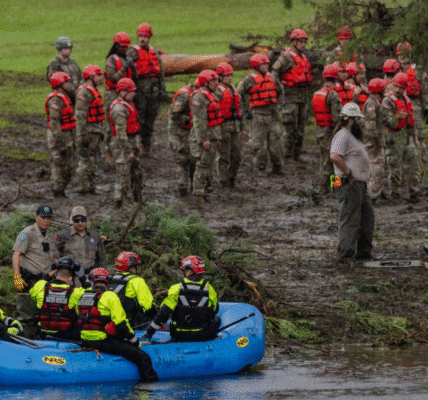
However, major issues can still arise from a tropical storm that is waning. As the storm travels onshore into South and North Carolina, there is a chance of isolated floods, fallen trees, and power outages.
Standby Power Crews and Shelters
Response teams have been activated by emergency management organizations in both states. When conditions improve, the additional staff that power companies have on standby are prepared to respond. Emergency shelters have been set up or made ready in several coastal counties in case evacuations are required.
Officials emphasize that locals should remain informed and be prepared to act swiftly in the event that the situation changes, even though broad evacuations have not yet been requested.
Be prepared and mindful of the weather.
Tropical Storm Chantal highlights the fact that even lower-category storms can still bring dangerous and disruptive impacts.
Let me know if you’d like other variations or a more concise version!
Despite not being as powerful as a hurricane, it poses a significant risk due to its combination of flooding, intense rainfall, and potential tornadoes.
Residents throughout the Carolinas are being advised by the National Weather Service and local officials to keep an eye on the most recent forecasts, register for emergency alerts, and refrain from any needless travel until the storm has passed.
Being ready is still crucial as the 2025 Atlantic storm season progresses. Despite not being the strongest storm, Chantal could have a significant impact on the entire region.